Explore Britain with me...

Thank you for joining me. My journey has only just begun (September 2014). I will be travelling around the coast of Britain over the coming years. I hope to see all the coastline and much of the interior. I am going anticlockwise and randomly started at the Dyfi Estuary, one of the most beautiful parts of Wales that I already knew, overlooked by the most beautiful mountain Cadar Idris. I am looking forward to seeing and recording all sorts of things. My own passion extends to wildlife, geology, scenery, history, architecture and I am interested to meet people and see the communities and towns that I pass. I have read different accounts on the length of the coast and it varies enormously, but at its extreme could be as much as 37000km, taking into accurate measurements and including all the islands. I don't think that's feasible, but much probably is! I suspect Ill use a combination of foot power, bikes and busses if I am to do it all. Perhaps I can use boats too and maybe even swim a bit.

Thursday, 2 July 2015

Arran Day 6 Sightseeing

Arran Day 6
Friday 19th June
Brodick castle, Blackwatersfoot to King’s cave
and Machrie Moor

Walk distance 9.5km
Cycle 0km
Height 0m
3 hours

Total coastal distance on Arran walked  54km
Running height climbed  1478 m
Total coastal distance cycled 0
Total coastal distance driven 0


I spent a couple of hours walking a round Brodick Castle gardens. Although storm damaged they were still interesting and there were unusual trees and a lot of color.  I was impressed by the tree ferns that grow in the relatively mild climate. Today the midges were out, even in the indoor cafĂ©. Afterwards, I drove to Blackwatersfoot and walked a relatively short distance around Drumadoon Point to the famous King’s cave. The route passes under some impressive cliffs.  A black headed gull came close to hitting me as I walked along the path, but too near its nest.  This was the first still day and the midges were out in force. Although within yards of the tide line it was free of midges.  The caves were very impressive but I did not have a chance to enjoy them in solitude as a dozen youngsters were camping in the largest cave, and a had a rather smoky fire alight. With the evening approaching I returned the same way and drove to a small car park near Machrie Moor to walk to the standing stones I had read about.
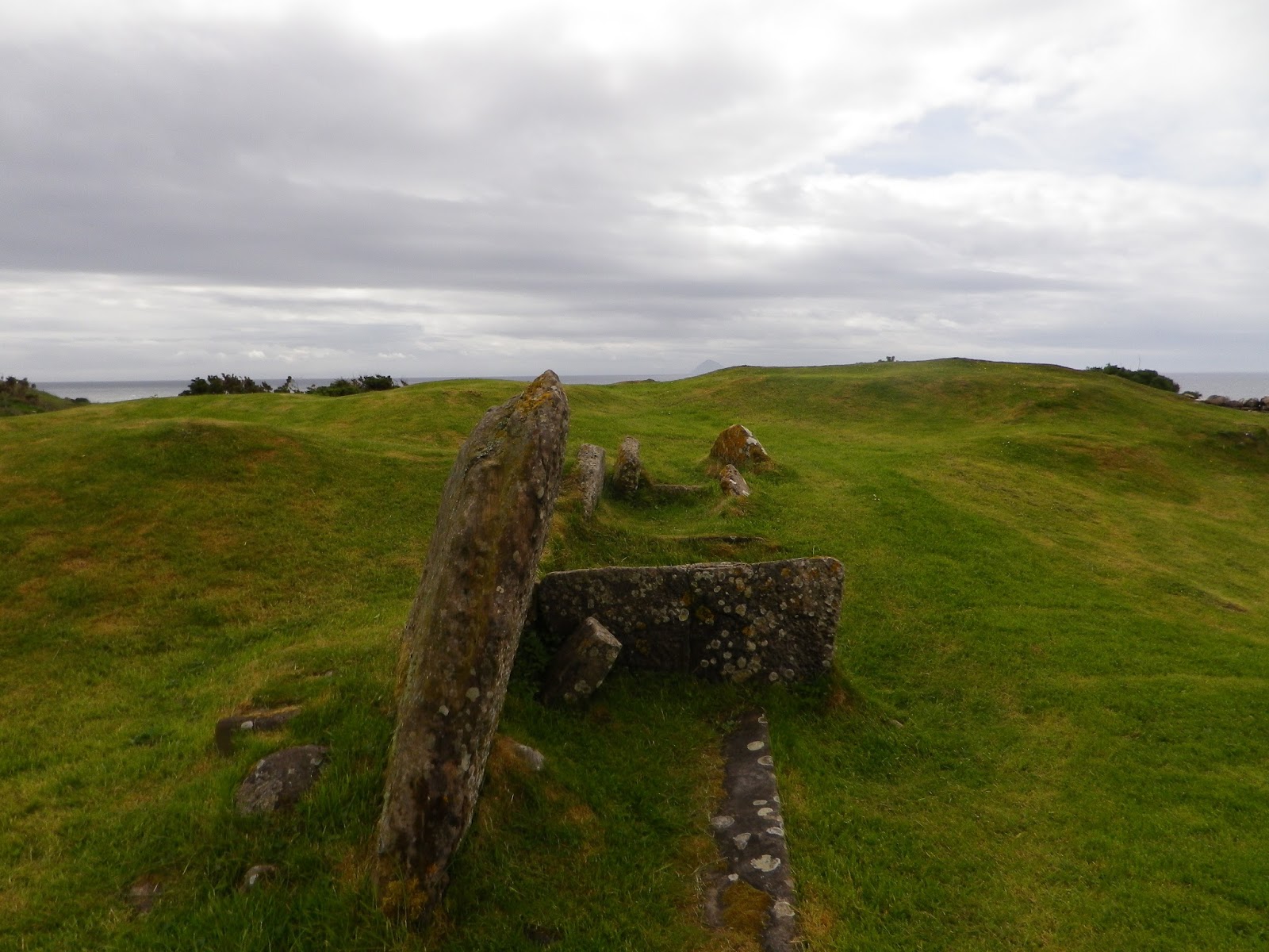
The walk, on a dry stone track, was easy.  I passed people leaving the site and was lucky to have the area to myself - that is except for the curlews that were calling. These added to the mystical nature. There were ancient tombs, small low circles of standing stones as well as two circles with very large stones within them. One stone looked rather phallic. The whole place, set amidst the mountains is very special.

This was a good place to end my holiday.  In the end I had walked much of the non road walking sections of coast, been up the highest mountain and seen a number of sights. I feel though a return trip is needed to see the last few sections of coast and also to walk some of Machrie Moor and the spectacular mountain ridges in the north.  In the evening I enjoyed  a lovely pint in the Drift Inn.


Arran Day 5 Sannox to Lochranza

Thursday 18th June
Sannox to Lochranza

Walk distance 15.5km
Cycle 0km
Height 119 m
5 hours

Total coastal distance on Arran walked  54km
Running height climbed  1478 m
Total coastal distance cycled 0,Total coastal distance driven 0


Enjoyed the drive over the narrow mountain road to Lochranza, a pass with steep drops and views of Arran’s peaks. Once parked up I had a chilly wait at a bus stop. Poorly designed with only one side so the wind whipped through it. I stood outside in the lee of it to avoid the wind. The bus took me back over the pass to Sannox. Sadly the open signs for the cafe were a lie. The walk started off across stepping stones across a small river, then followed some beeches. Here I found tadpoles in shallow rock pools above the high tide and also butterwort growing in crevasses in the sand, proving that peat is not needed to grow carnivorous plants in.  The path then crosses a bigger river and skirted a large plantation, following a newly laid forestry track. There were huge stacks of timber and hundreds of yards of winch cable lying on the track. One tractor and trailer laden with timber passed me. Then I passed about eight foresters caravans on the beach. This was forestry on a massive scale. A couple told me how the path was ruined. I had little sympathy. Much of the time it may seem like  a tranquil place, and people probably think it natural.  Folk do not realise this is industry, the trees are all planted and they are walking through a factory floor. In order to harvest the timber the ground gets disturbed. Rather like modern intensive agriculture, intensive forestry is disastrous for wildlife. When operations happen it looks even more terrible. But unlike agriculture there has been a real move to have sympathetic forestry in recent decades, e.g. not planting on watercourses and planting native species. 


I then came across the crux of the operation. Complete clear fell of conifers. The entire hill side bare, trees were being winched down by enormously long cables mounted to a crane, anchored into rock on the shore. The trees arriving at the base of the slope were grabbed by a 360 and stripped of branches and cut to length. There was even a slip way for a boat to pick up the timber. It did look devastating. But what replaces it will be better than the early stile forestry plantings. The Forestry Commission is one of the most valuable assets we have. Long may it last. After the works were passed it suddenly all seemed natural. I passed several caves including one with  a sleeping bag hanging up in it. It was a perfect setting and faced away from the wind. The wave cut platform here was narrow so it looked less useful for grazing and I thought there was no sign of human activity.  A real surprise was a boarded up cottage, with no access road, in the middle of nowhere, much further along the coast.  This is in an absolutely beautiful setting, backed by huge hills with a small burn and right on the beech. No electricity here. A bit further on and more signs of people. A ruined salt factory, pits and buildings as well as a grind stone. On the hill side were stone walls. No where has escaped human interaction. Then gradually the grassland strip narrowed as I approached the headland. All this time the wind had been directly on me, and without sun it felt cold. A few times a shower passed through.

I didnt see much wildlife today. Perhaps the strong wind put it off. The forecast had been for a north westerly. I chose the walk because most of the route would be sheltered. But the wind was north easterly. After rounding the headland I pressed on looking forward to getting out of the wind. Gradually meadows opened up. A number of woodlands had been passed. Within these an indigenous whitebeam grows. I did see it in flower in the distance. With my head down I failed to notice the famous geological unconformity named after Hutton, until I saw a sign a mile on. I decided I could survive without it. I arrived in Lochranza just as rain came on hard. Besides the beauty if the loch, castle and older buildings; I found it a dreary soulless place. Big houses with inappropriate names like Croft. Huge ugly deer fences protected bland mown lawns. Sadly tipped garden waste below the public water front was almost certainly from the big houses.  Sad people trash in such a beautiful place. A village with no proper pub or shop. More like so many cotswold villages. But more bus stops and post boxes than necessary! The castle was interesting though.
I must balance this up by saying that Lamlash where I was staying is a delightful village with lots of amenities.  Also in every shop, bar or restaurant I went in I found lovely friendly staff.


Thursday, 18 June 2015

Arran Day 4 - Lagg to Kildonnan

Arran Day 4
Wednesday 17th June
Lagg to Kildonnan

Walk distance 8.5km
Cycle 0km
Height 0 m
6 hours - 3 hours waiting for tide to drop

Total coastal distance on Arran walked  38.5km
Running height climbed  1359 m
Total coastal distance cycled 0
Total coastal distance driven 0


Failing to beat the self timer on my camera

Parked at Whiting Bay, which was where I was hoping to walk to by the end of the day.  Caught a bus to Lagg Hotel and walked the first section to find the ancient barrow of Torrylin Cairn, a Neolithic chambered tomb, used for communal burials.


Weather wise it was a little windy and it looked as if rain threatened.  But the wind was behind me and at one point it did rain hard. The first section of the walk is along really nice beaches and super views of Ailsa Craig island.  A stray cloud made it look as if the island was erupting.  65 million years or so after it last did so.


 Early on I saw one seal but otherwise it seemed quiet.  I reached the large boulder that marks where the Black Cave.  It was easy to get into the cave and explore it.  It is Arrans largest cave.  I presumed some rock pipits had a nest nearby as they kept calling in alarm and flying around the cave entrance.
Adjacent to the cave is a fine waterfall plummeting over the old cliffs.  The tide was nearly at its height so it wasn’t possible to walk around Bennan Head.  I decided to have lunch and wait. I found a large rock that sheltered me from the wind.  As I waited I could see gannets occasionally fly close by. These might nest on Ailsa Craig - an island renowned for its breeding gannet colony.  Every  now and then I checked the tide but it took a long time to turn and drop.  I waited for close on three hours, but enjoyed it thoroughly, just soaking up the atmosphere and peace.  In fact once it was safe to do so without getting wet feet I realised I could have climbed around the headland quite safely.  The bigger challenge was the boulder field  beyond. These boulders were of all sizes and at many angles. Thankfully they weren’t slippery if you avoided the ones below the tide line.  In places there were small boulders and pebbles but these tended to move around and weren’t so stable. Another peregrine announced its presence and called constantly as I walked below its cliff, and presumably nest. Once beyond this a gentle machair grassland fringed beaches. The beaches have scattered boulders and pebble areas. Also large igneous basalt dykes project into the water. Some of these look artificial, just like groynes built into the breakers.  A few did have boulders added to them to act a stock barriers.    In places seals rested on these dykes and a few perched seemingly precariously on rocks in the water.


The island of Plada, with a round lighthouse was now clearly visible. Cattle grazed the machair. The village store marked on the OS map doesn’t exist anymore.  At the Kildonan Hotel by an old telephone exchange building I decided to head back, as it was already well into the evening.   The next section to Whiting Bay is apparently very slow going as its all boulders.


Tuesday, 16 June 2015

Arran Day 3 Holy Island

Day 3
Arran Day 3
Tuesday 16th June
Holy Island

Walk distance 7km
Cycle 0km
Height 345 m
3 hours

Total coastal distance on Arran walked  30km
Running height climbed  1359 m
Total coastal distance cycled 0
Total coastal distance driven 0


The ferry crossing cost  £12. In fact it was more of a small boat, so ferry is perhaps gives the wrong impression . Three Canadians, two Scots and a Dutch man crossed with me. The crossing probably took 15 minutes. On the floating pontoon at Holy Island, we were welcomed by a volunteer living on the island. This lady, in a colourful dress, and very cheery disposition explained the holy nature of the site and also suggested where we may like to visit. The backdrop to the grazed lawn was a rather beautiful house set off with many Buddhist prayer flags. This is the Centre for World Peace and Health. http://www.holyisland.org/  The island is owned by Buddhist monks.    I took the walk over the hill. The path went by a large plantation of native trees, planted by volunteers. Fenced off to keep the islands animals off. On Holy island are native goats, Soay sheep and Eriksay ponies. All are wild.


Up above the trees the path winds up through moorland. Amongst the heather, especially at the south end I saw bearberry growing.


This delicate looking plant formed a bright green and red carpet under the heather. All three heathers were growing side by side, with bell heather in flower. The views from the top - Mullach Beag, included Goat Fell, although today it was  partly shrouded in cloud. The path down was fairly steep and the cliffs to the west very high. Among the heather I saw a few flower spikes of heath spotted orchid as well as tormentil and heath bedstraw. At the south end I was surprised to see a very attractive square towered lighthouse.


Here I had lunch, whilst watching cormorants out at sea. Above common gull made a racket. They were nesting on steep scree slopes. Presumably there are no foxes or badgers around. The return path is at sea level following a track way on the wave cut platform. Another lighthouse and cottages, in a similar stile are fenced off. These, as well as hill side pods and cabins are retreats. Nuns live in the cottages. Why cant I get carry on film ideas about nuns out of my head? On the way back I saw lots of soay sheep on the shore as well as a few ponies. A common gull dive bombed me even though I was a long ways from its nest on a scree slope.  In places I spotted  interesting plants such as sundew, marsh orchid and climbing fumitory. I got an impression of neglect of old shoreline pastures, swamped by bracken. I also thought the tree planting could be misguided unless it was well planned. I thought it would  not be many years before the orchids vanish under the shade of trees. Buddhists believe in not killing anything, but I cant see how that works if you want to manage land. Nature is so linked to our traditional management systems that much vanishes without our actions. The same though is true for the lack of that we do since traditional management has ceased almost everywhere in the countryside. The road verges mentioned before are just one example. Further on I passed beautiful paintings of Buddhist images on rock outcrops.


Then the cave of St. Molaise, this Irish saint lived here years ago around 600AD. Shrill calls from a crag attracted me but scanning with my binoculars I could see no sign of young bird of prey. Until a female peregrine swooped in to feed them. The nest was too hidden though to see the young. Finally I visited the little Buddhist shop for a welcome coffee. The sea was a little rougher on the way back, splashing some in the boat.  The Dutch guy was very chatty. We shared concerns about the state of the world and worried about pollution from farming and fisheries. We talked about the unique no catch zone set up south of holy island. This is the first in Scotland. It provides a refuge for sea life to breed.  The Community of Arran Sea-bed Trust influenced Government to set up the zone in 2008. Afterwards I went to the pool at in Brodick. A really nice swimming pool complete with sauna, steam room and footbaths. In the evening had a very nice Hawaiian pizza at Lamlash Bay Hotel.


Arran Day 2 Brodick to Corrie - Goat Fell

Arran Day 2
Monday 15th June
Brodick to Corrie - Goat Fell

Walk distance 11km
Cycle 0km
Height 874 m
4 hours

Total coastal distance on Arran walked  23km
Running height climbed  1024 m
Total coastal distance cycled 0
Total coastal distance driven 0

Parked at car park near to the Castle

The Arran beer shop at the start looked inviting and I hoped to make time to come back and visit. The first part of the walk was a steady climb up a good forest track. It made a change to walk in a forest. There had been some clearing of trees. The resulting fresh growth of purple flowering rhododendrons and the pale green tips of sapling spruce was very striking. Even if rhododendron is an introduced plant, and a very invasive one - it is beautiful.  If I stopped for too long the midges started to home in, especially as the air was still and warm. 
Spikes of bog asphodel just emerging from the peat


Once above the forest the hills are clad in heather, both ling and bell heather. The b ell heather is already in flower.  In damper places sweetly scented bog myrtle grows.


I was pleased to find a few flowering common butterwort in bloom too. There delicate mauve heads protruding above their deadly leaves. Wildlife as so often on mountain and moorland was not obvious. But a raven obliged and sat calling nearby while near the top I saw one dive, closing its wings and dropping so fast.  The path gradually became narrower and before long it was a mix of smooth natural stone boulders and slabs as well as steps. The land is owned by the National trust for Scotland, so I assume the steps had been built by volunteers. Although dry today the numerous gullies that had been built indicated that the path could be quite wet.  Up to just below the spur leading to the steeper ascent I had not seen anyone. Then a few started to pass me on there way down. I could now see many people ahead of me looking small in the distance.  Following their progress I could now see the way up to the summit of Arran’s highest mountain, Goat Fell. Everyone greeted one another. The higher I went the more steps there were. The path made the way easy. On the downside it felt a little artificial. In some ways it was also harder on the knees as there was little variation in how you could walk.  (in fact coming down was painful).


The final steeper climb was well worth it. There were some distant low clouds but it was possible to see Jura Kintyre, Ayrshire, Bute and much of Arran. The nearby knife edge ridges were spectacular. I would like to return to walk more of these mountains. On the summit is a white trig point. There is also a direction finder showing all the features you could make out. Amazingly the wind was calm and the sun shone.


After returning the way I had come to start with, I then followed a different path down to Corrie. This was an attractive route with less people. It was only at the edge of the forest that I checked the time. I had walked for longer than I realised. My choice was to rush down to catch the next bus or to give myself three hours before the next bus. I decided on the former. The last bit was a bit too quick, so I barely had time to appreciate the roaring stream that the path followed.  The numerous horse flies failed to catch me.  Arriving on-time, and dropped off before 5pm I had time to call in at the Arran brewery shop and try a beer I had not had before. I ended up buying a case.  Spent part of a pleasant evening in the Drift Inn enjoying the view of Holy Island.